Investigating the Potential of Consumer-Grade LiDAR in Construction Management
This project evaluated consumer-grade LiDAR (CGL) for construction tasks, exploring its potential as a low-cost, efficient tool for floor flatness and site documentation.
Investigators
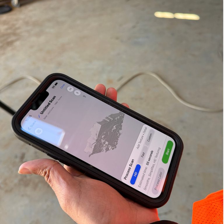
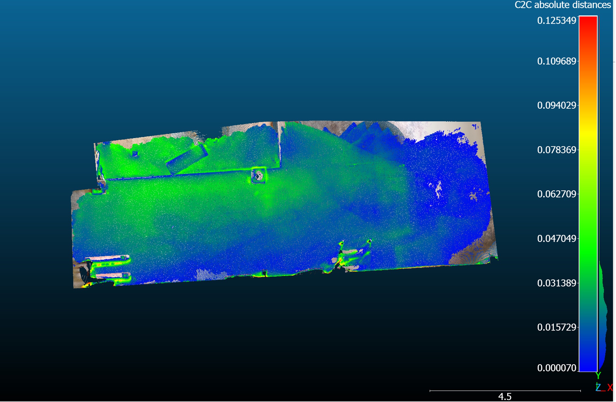
This CCIC-funded project investigated the potential of Consumer-Grade LiDAR (CGL), particularly smartphone-based sensors, for applications in construction management. A literature review was conducted to identify current applications, limitations, and opportunities for CGL, leading the team to focus on floor flatness evaluation as a key application area. Two field case studies were completed in collaboration with contractors at active construction sites. The research team compared data collected using CGL (iPhone 13 Pro Max) with that from traditional Terrestrial Laser Scanning (FARO S-350) and photogrammetry tools (Matterport Pro-3, Insta X3/X4). Performance was evaluated based on accuracy, efficiency, and cost-effectiveness. Surveys and interviews with VDC engineers, project managers, and field staff provided qualitative insights into the practicality and usability of CGL on construction sites. While CGL showed some limitations in precision, it proved to be an accessible and efficient tool for rapid site assessments, particularly for small to mid-sized projects. Findings have been submitted in a scholarly paper, “Photogrammetry as an Affordable Alternative to Laser Scanning for Small and Mid-Size Construction Firms,” currently under review for the 2026 ASC Annual Conference.
See more in:
CCIC Awardees
Related people:
Junshan Liu